
vPlan AR
Scans spaces with LiDAR or draws floor plans on the web for architects.
Product memo
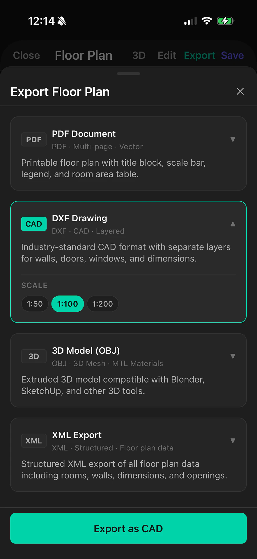
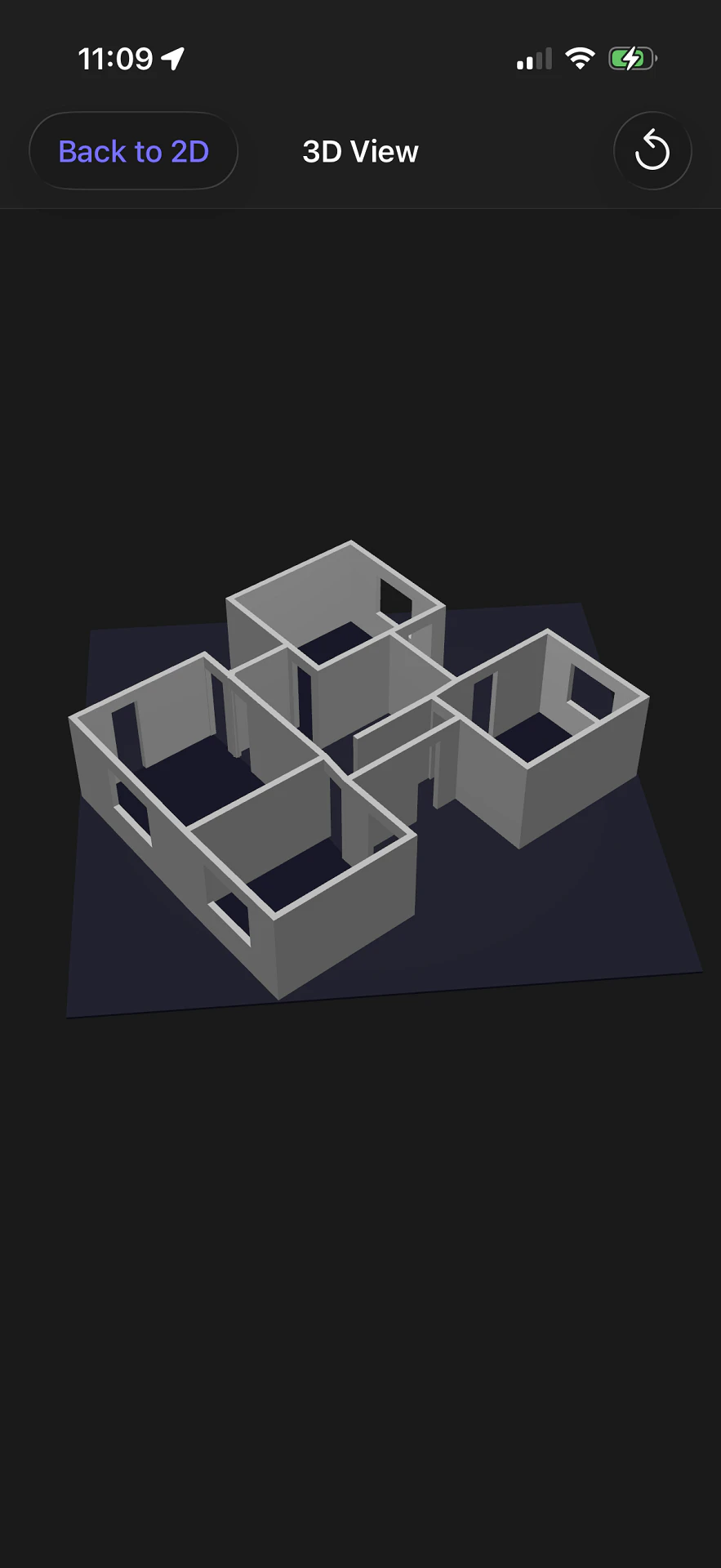
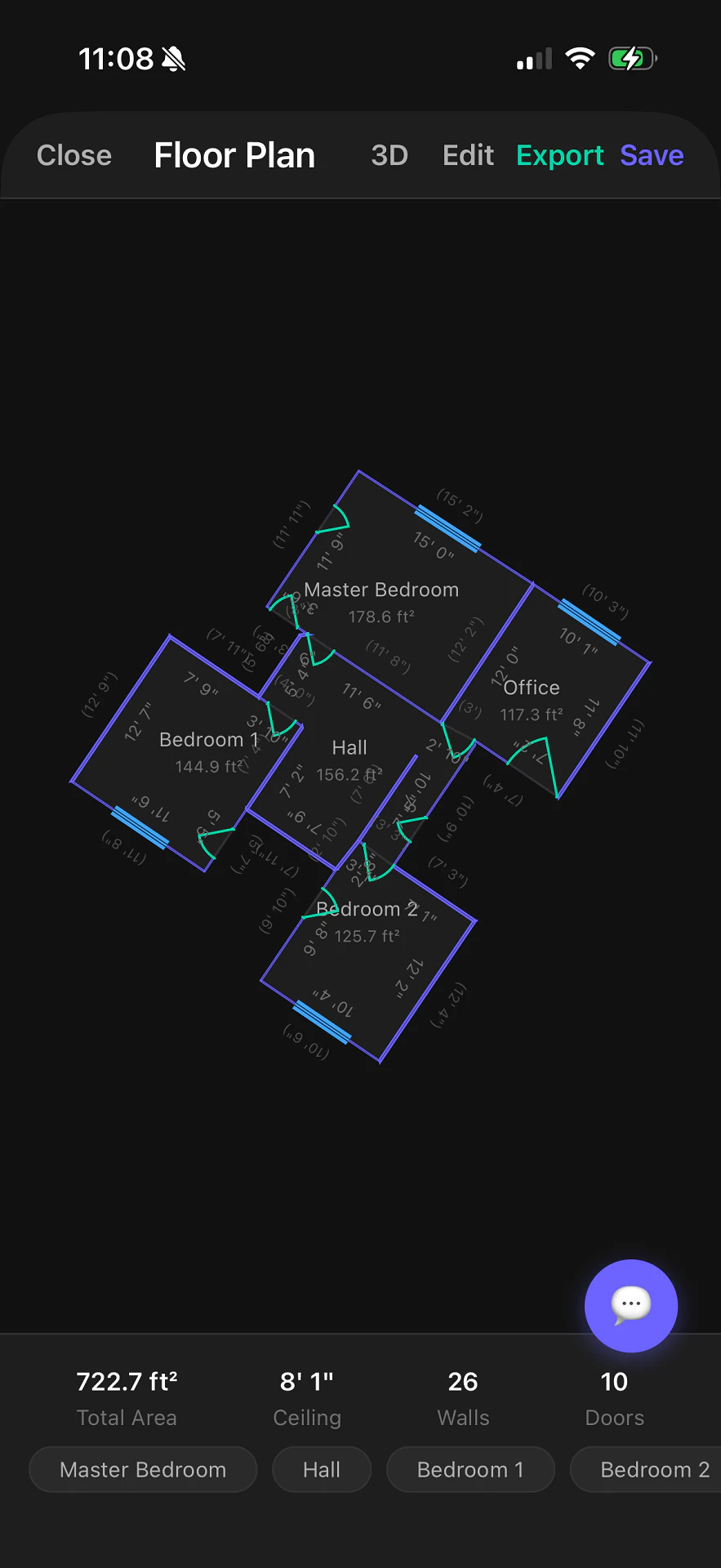
Architects, designers, and documentation professionals use vPlan AR to create accurate floor plans. It captures spaces with LiDAR on iPhone and iPad, or users can draw from scratch on the web. This dual approach, combined with exports to PDF, CAD, OBJ, and XML, offers a flexible way to document spaces.
- For who
- Architects, designers, and professionals documenting spaces
- Solves what
- Creating accurate floor plans from scans or manual drawings
- LiDAR scanning for automatic measurements
- Web-based manual drawing tools
- Export to PDF, CAD, OBJ, XML
In their own words
Scan. Draw. Export. Floor Plans Built for Professionals.
Capture spaces with LiDAR on iPhone and iPad, or draw from scratch on the web. Export to PDF, CAD, OBJ, and XML in seconds.
Commercial cues
- Model
- subscription
- Free tier
- Yes
- Trial
- 14 days
Pricing strategy
- • A free tier with project limits acts as an adoption wedge.
- • Annual billing offers a lower effective price to secure longer commitments.
- • 14-day trial lowers adoption risk.
About vPlan AR Expand
VPlan AR provides a flexible way for architects, designers, and other professionals to create detailed floor plans. It offers two primary methods for capturing space: LiDAR scanning using an iPhone or iPad for quick, on-site data collection, and a web-based editor for precise manual drawing.
Users can export their plans to various professional formats, including PDF, CAD, OBJ, and XML. This blend of mobile capture and web-based editing positions vPlan AR as a broad tool for documenting and visualizing spaces.