

Product memo
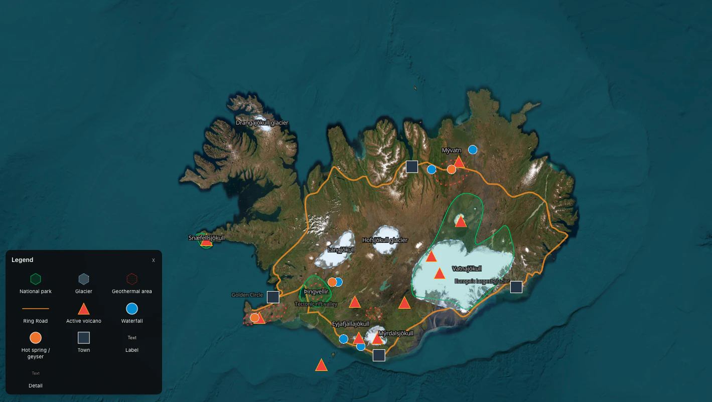
Idomaps offers a free, browser-based cartography tool for non-GIS users. It focuses on visual storytelling and ease of use, enabling creators to quickly design and share thematic maps for education, travel, or content illustration. This approach differentiates it from complex GIS software through an accessible interface and rich styling options.
For who
Storytellers, teachers, bloggers, and travel writers
Solves what
Creating and sharing thematic maps online without complex software.
- Browser-based map editor
- Precision drawing tools
- Custom styling and icons
In their own words
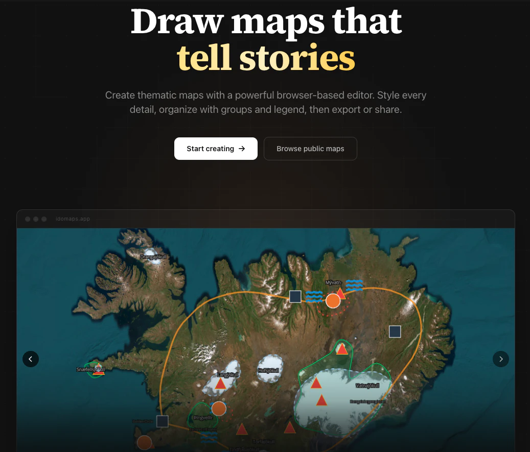
Draw maps that
Create thematic maps with a powerful browser-based editor. Style every detail, organize with groups and legend, then export or share.
Draw maps that tell stories
Commercial cues
Model
free only
Free tier
Yes
Trial
No
Pricing Strategy
A free-only model positions idomaps as an accessible tool for creators, prioritizing user adoption over direct pricing.
- • The completely free offering removes all pricing friction for new users.
- • It focuses on adoption to build a user base for potential future.
- • Free tier lowers testing friction.
Operator context
Operating setup
Team
Indie / lean
LLM classification
Founded
May 2026
Platform
Web app
Audience
Creators
Builder Strategy
- Strategy Type
- Niche Specialist
- Stage
- Bootstrapped Lean
- Effort
- Solo Buildable
About idomaps Expand
Idomaps provides a browser-based map editor for storytellers, teachers, bloggers, and travel writers. It helps users create and share thematic maps online without needing complex GIS software.
The platform focuses on visual storytelling and ease of use, offering precision drawing tools, rich styling options, and a legend system. This makes it an accessible choice for content illustration and educational purposes, allowing creators to design and embed maps via iframe.