
AI-powered GIS platform for maps and spatial workflows from natural language.

Product memo
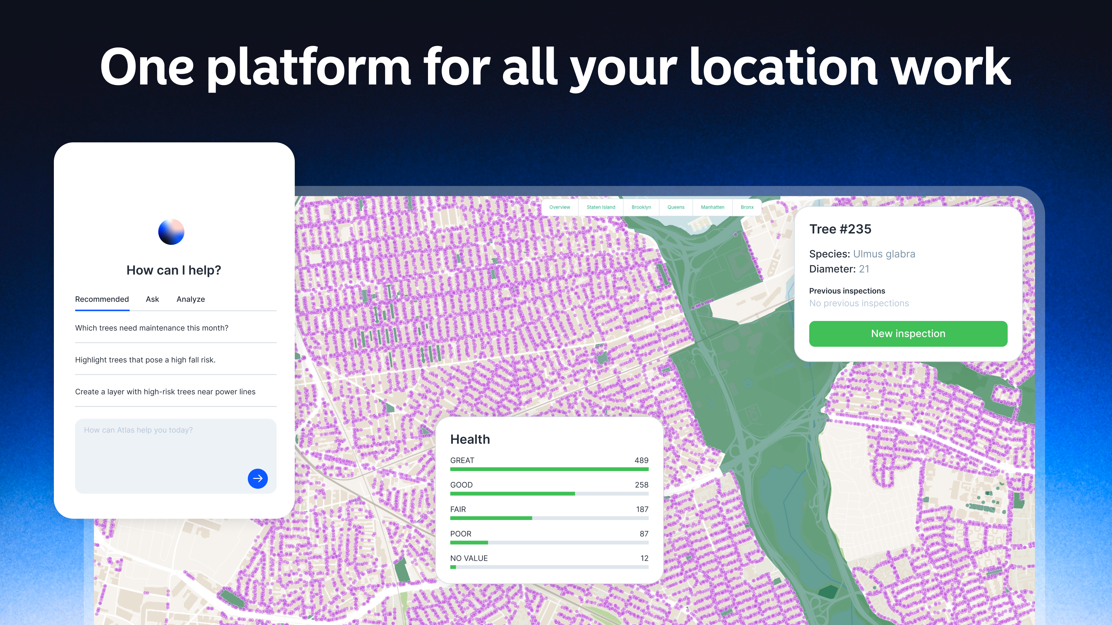
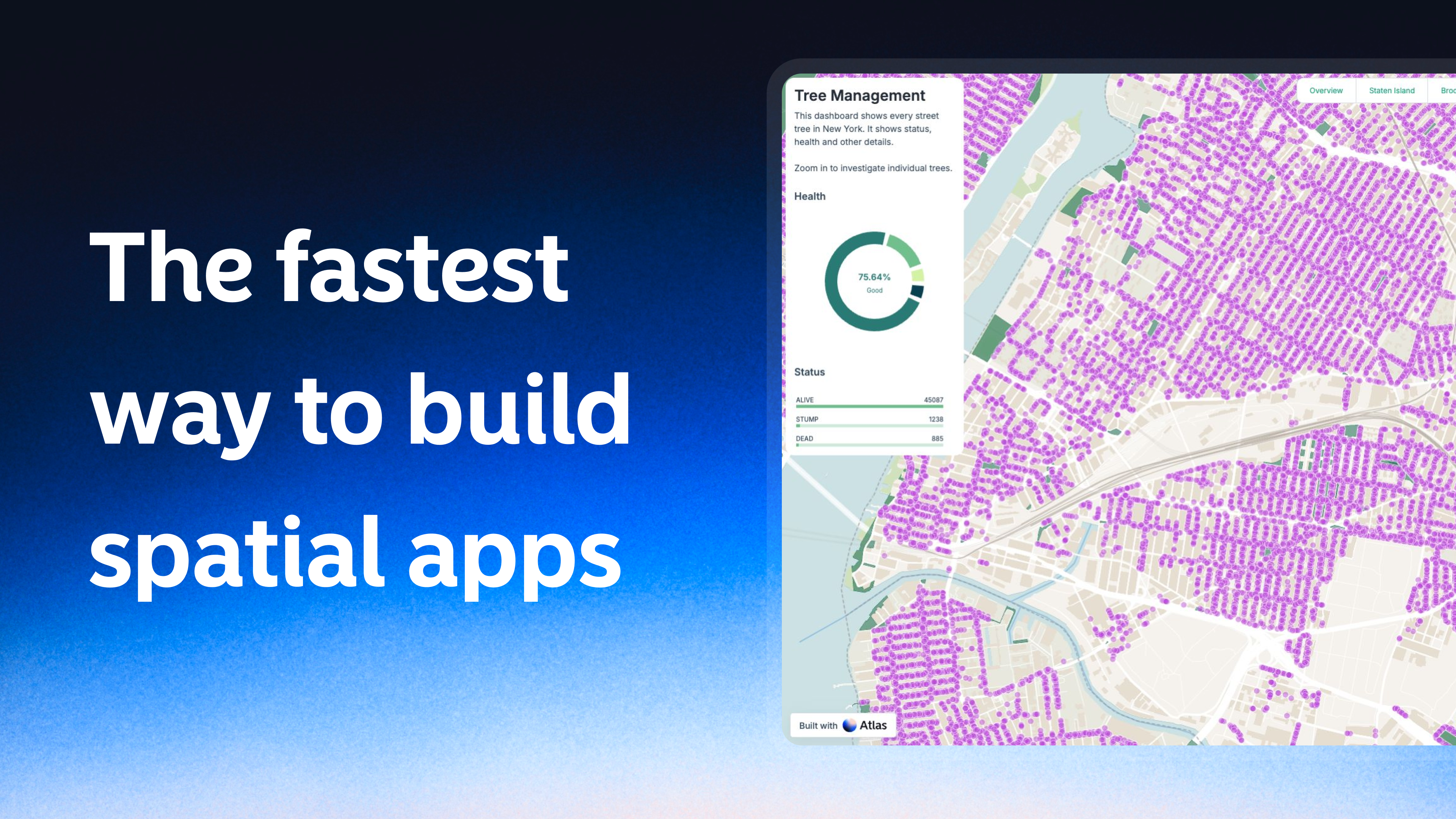
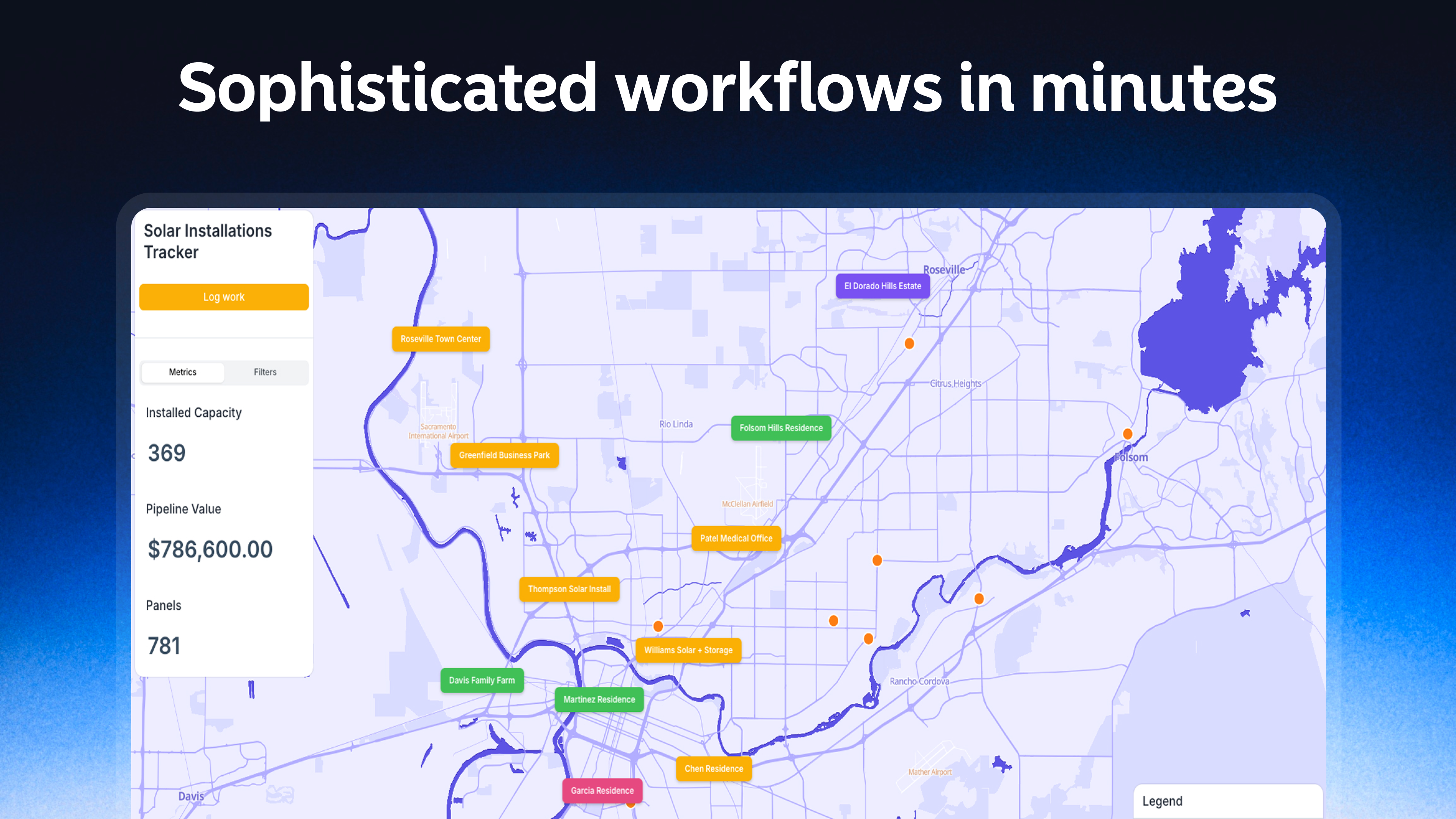
Atlas gives energy, infrastructure, and real-estate teams an AI-powered GIS platform. It builds maps, dashboards, and spatial workflows directly from natural language. This conversational approach makes GIS-grade analysis accessible to entire teams, moving beyond traditional desktop software or specialized training.
For who
Energy, infrastructure, and real-estate teams
Solves what
AI-powered GIS platform for building maps, dashboards, and spatial workflows from natural language.
- Agentic GIS platform
- Build maps from conversation
- Connects scattered data sources
In their own words
The Agentic GIS Platform
Atlas is the AI-native GIS for modern teams. Connect your data, describe what you need, and ship a live map your whole organization can use — built for both GIS pros and everyone else.
Atlas is the AI-native GIS for modern teams. Build maps, dashboards, and spatial workflows from a conversation — GIS-grade analysis, accessible to your whole team.
Commercial cues
Model
usage based
Free tier
Yes
Trial
No
Pricing Strategy
- • A free Starter tier lowers adoption friction for new teams.
- • Usage-based pricing on AI credits and runs scales with feature adoption.
- • Project-level permissions on Team plans drive multi-user adoption.
Operator context
Operating setup
Founded
Jan 2026
Platform
Web app
Audience
General
Social footprint
Tech stack
Builder Strategy
- Strategy Type
- Ai Wrapper
- Stage
- Vc Growth
- Effort
- Small Team
About Atlas Expand
Atlas is an AI-native GIS platform designed for modern teams in energy, infrastructure, and real estate. It allows users to build maps, dashboards, and spatial workflows using natural language prompts, democratizing access to GIS-grade analysis.
The platform integrates data sources and supports real-time collaboration, making complex spatial analysis accessible to a broader audience. Its positioning around conversational map building and spatial analysis workflows helps teams adopt advanced mapping capabilities without extensive training or specialized software.